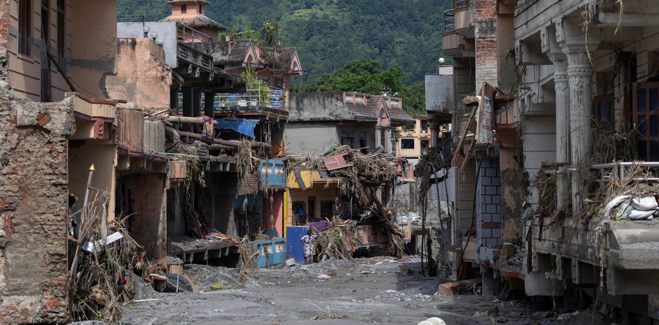
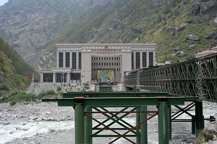
Within the space of a few minutes on August 26, the border crossing between Nepal and China – Rasuwagadhi on the Nepali side and Gyirong on the Chinese – was destroyed by a flash flood caused by a collapsed glacier. Villages, bridges and roads on both sides of the border were washed away.
Hundreds are dead and many more missing, including tourists and pilgrims. The full toll will not be known for days as the worst-hit areas are hard to reach. In the case of Tibet, given the history of China’s draconian control over information, the true toll may never be known.
Already impoverished, Nepal faces grave challenges of rebuilding once the relief effort is over. This is the first real test for the government that took power in March after a successful gen Z revolution swept away the traditional parties.
Prime Minister Balen Shah’s government has tried to avoid becoming dependent on either large neighbour, China or India, or trapped in their rivalry. It has asserted some strategic autonomy by dealing with New Delhi, Beijing and Washington on an even footing.
The fact that Nepal’s neighbour is Tibet, a previously self-governing region that China took over by force between 1950 and 1951 and has administered ever since, makes flooding in this border region harder to prepare for.
A militarised frontier
Despite warm relations with Beijing, and the Nepalese government’s assurances that it follows the “One China” principle and permits no support for Tibetans, China’s tight control over Tibet creates complications.
The region is administered as a militarised frontier. Access runs on permits and clearances, the area is closely watched by armed police and the military and outsiders – foreign journalists, independent researchers, at times even diplomats – are routinely kept out. Tibet is an information black hole.
Beijing’s anxiety extends across the border as Nepal is home to more than 10,000 Tibetan refugees and has long been the main escape route out of Tibet. China pressurises Nepal to police Tibetan activism, seal crossings and fold border management into a security partnership meant to insulate the plateau from the outside world.
The glacial and hydrological data from the Tibetan plateau, the information often needed to anticipate flooding, is also treated as strategically sensitive by China and is closely held. Nepal has no mechanism to receive real-time glacial lake and river data from the Chinese side and its officials have sometimes gone further, accusing Beijing of withholding it.
When a disaster in the Nepal-Tibet border region demands that rescuers cross quickly or that a warning travel downstream from an upstream lake, it runs into a system built for control rather than speed.
Growing evidence suggests the recent glacier collapse happened on the Nepalese side of the border, near the Langtang Lirung peak. But wherever the flood began, no warning reached the people in its path.
Officials in Nepal’s Rasuwa district said they had “no clue” it was coming. Some of this will have been down to the speed of the ice-avalanche flood, which may have left little to warn of. Nepal’s own monitoring stations upstream were swept away before they could send an alert.
But as I have argued in my own research, there is a deeper, more structural point to make here. There is no standing, obligatory system to move warnings through this border region in real time. Much of the data that could carry such a warning sits inside a region that China governs first for state security.
When a lake in Tibet burst in 2016 and flooded the Bhote Koshi river in Nepal, for example, no warning came either. Nepali hydrology officials said afterwards that China had for years failed to share “essential” data on the glacial lakes on its side of the border.
Cooperation between the two countries is not wholly absent, but it is thin and reactive. China and Nepal jointly monitor a single dangerous transboundary glacial lake, Cirenmaco. This is a system built for slowly forming lakes rather than a sudden avalanche in an unwatched valley.
Across this frontier, information moves only as far as security allows. But, as the latest disaster may show, the danger for Nepal is not only external. Nepal’s own reckless development – roads, dams and settlements pushed into fragile valleys – combined with corrupt officialdom and little early warning capacity of its own has raised the toll of every flood.
Borderlands the world over – India’s Himalayan frontiers among them – are often governed first as security zones, and disaster response tends to suffer for it. In 2025, after a terrorist attack in Kashmir, India suspended the Indus Waters Treaty and cut the flow of hydrological data to Pakistan. When monsoon floods struck months later, Islamabad said the suspension had made them worse.
Climate change is turning the Tibetan plateau into a source of cascading danger for everyone downstream, from Nepal to India and Bangladesh. Addressing it means treating the Himalayas as a shared ecological space that is a zone of contact rather than a zone of conflict.
Strengthening cross-border data-sharing and early-warning systems would reduce the lethality of earthquakes, landslides and floods. For the Nepalese government, this is where strategic autonomy will really be tested – not in choosing between Beijing and Delhi, but in insisting that the safety of its people is not hostage to the security anxieties of another state.
Floods, earthquakes and other natural disasters will occur again and again. The question is whether states in the region can improve at cooperating and prioritising people over border security.