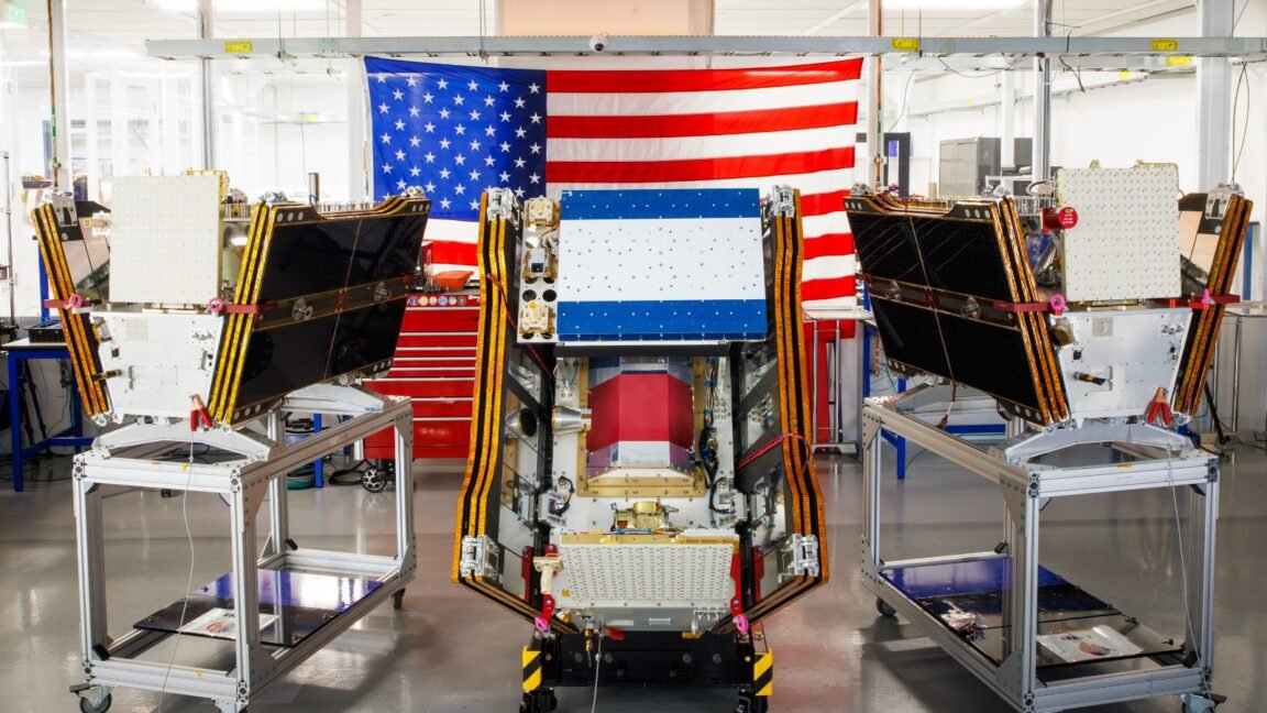
As smoke from hundreds of burning wildfires spread across Canada and the United States, the first three operational satellites in the Google-backed FireSat program successfully launched into orbit. The satellites will begin providing wildfire detection capable of spotting even small fires in the United States, Australia, and Europe before the end of the year.
The launch of the microsatellites aboard a SpaceX Falcon 9 rocket from Vandenberg Space Force Base in California on July 7, 2026 marks a transition to “initial operational capability” for the FireSat constellation managed by the nonprofit Earth Fire Alliance. After a three-month testing period, the three satellites will begin actively providing data to fire agencies while covering every fire-prone region on Earth at least twice per day.
FireSat represents the first satellite constellation purpose-built for detecting wildfires, including spotting smaller fires that other satellites may miss. The satellites were designed by California-based satellite manufacturer Muon Space and have received over $15 million from Google to support initial deployment. Other notable financial supporters include the Bezos Earth Fund that committed $26 million.
Each satellite is equipped with multispectral imaging that can peer through smoke and clouds and detect fires as small as five by five meters—about 16 by 16 feet. That capability was proven by a FireSat Protoflight satellite that launched in March 2025 and collected more than one million images, while showing it could detect low-intensity blazes invisible to existing satellites.
The “early adopter” organizations that will start using FireSat data this year include fire agencies in California, Colorado, Australia, and Portugal. As more satellites launch, the FireSat program aims to provide the latest imagery anywhere in the world on an hourly basis by 2029. Such imagery would eventually become available every 20 minutes once the full constellation of more than 50 satellites is launched by the early 2030s.
Detection of small wildfires before they burn out of control could prove extremely helpful. The Earth Fire Alliance has projected that even an hourly revisit rate by the FireSat constellation could help save more than $1 billion in fire damage costs and prevent nearly 22 million tons of carbon emissions, along with protecting 3,500 homes and 1.3 million acres of land.
To assist with that capability, Google Research plans to use the company’s AI models to compare operational FireSat data with historical images in order to accurately identify very small fires and to inform predictive modeling of wildfires. Google celebrated the launch of the first operational FireSat satellites by describing the event as “another tangible step forward in putting practical AI to work for climate resilience.”
The trouble with fires and climate change
But Silicon Valley’s rush to deploy newer AI models has also come with considerable climate costs that are linked to a worsening wildfire problem. Larger AI data centers require massive amounts of electricity that are often being met by new natural gas projects in the United States, which could collectively emit more than 129 million tons of greenhouse gases per year. Google has itself acknowledged the challenges of deploying enough clean energy projects to offset potential emissions from energy-hungry data centers, especially as its company-wide electricity usage grew by 37 percent in 2025.
Google’s financial and technical support of AI-powered wildfire detection could prove incredibly helpful. But wildfire detection is just one of multiple elements necessary to prevent blazes from spiraling out of control—fire agencies also need enough resources to manage ecosystems through prescribed burns and to put out unwanted fires. And their job has become increasingly challenging because of global warming.
Traditional fire suppression has proven inadequate in the case of the wildfires that began spreading in Canada’s boreal forests this summer and has forced thousands of people in First Nations communities to escape the fast-moving blazes. The wildfires have also generated smothering smoke clouds across Canadian and US cities while inflicting hazardous air pollution upon more than 100 million people.
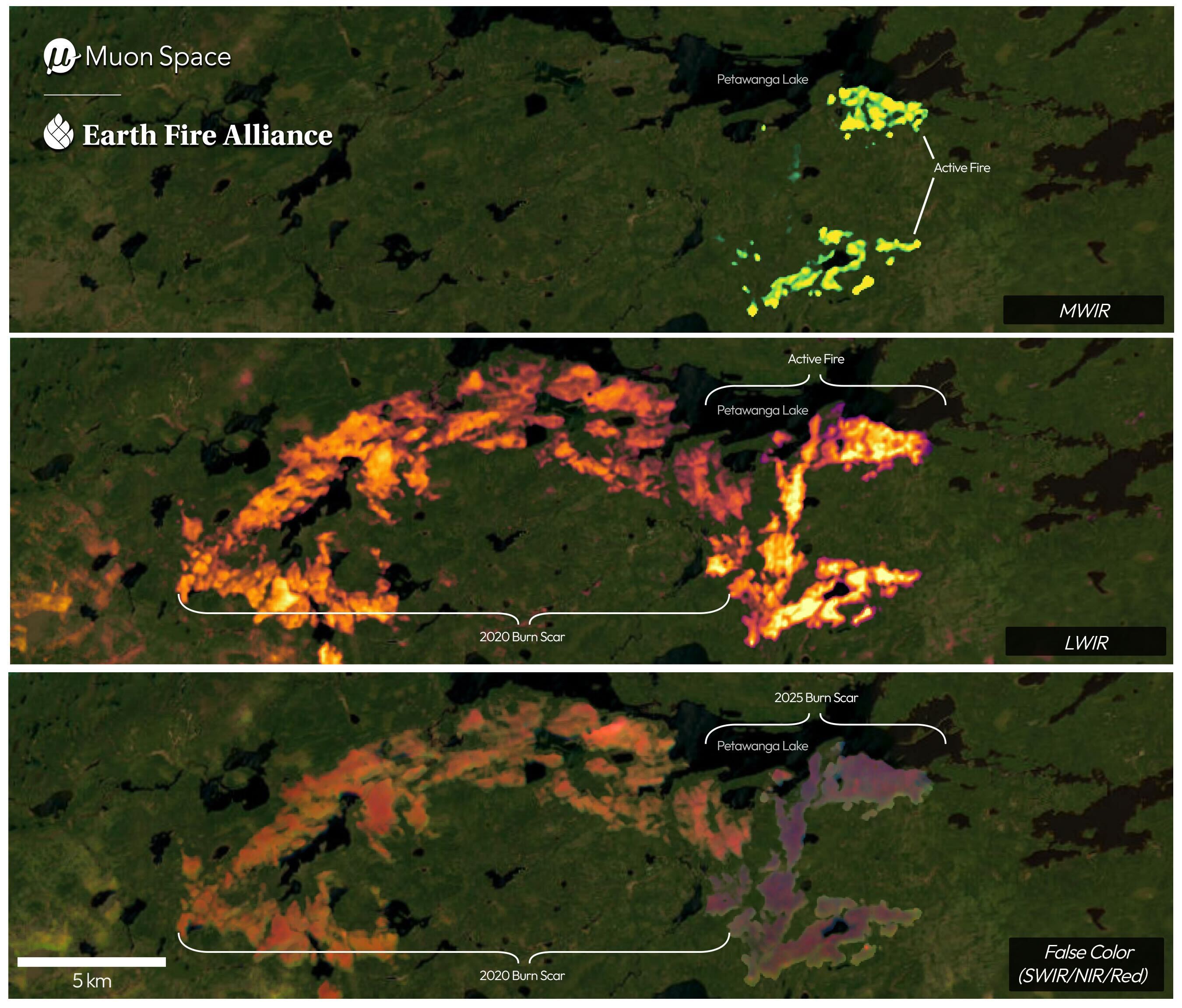
The wildfires in Canada’s boreal forests are burning with greater size and intensity because of climate change, as greenhouse gas emissions from human use of fossil fuels continue to drive global warming. Two of Canada’s most destructive wildfire seasons occurred in 2023 and 2025, and the last three fire seasons were among the 10 worst on record.
“What is unfolding is what climate and forest scientists have been predicting for 30 years,” Werner Kurz, a retired senior research scientist at Natural Resources Canada, told The Atlantic. “That as the world gets hotter and drier, we are exposing forests to more and more risk, and the old strategies of fire suppression are simply being overwhelmed.”
Fighting wildfires in mostly uninhabited forest regions requires fixed-wing air tankers and heavy-lift helicopters capable of dropping fire retardants on wildfires or transporting firefighting crews to the remote sites. But individual Canadian provinces usually bear the burden of buying or contracting for such firefighting aircraft, and every available aircraft has often been required to fight wildfires in recent years. This year the Canadian government leased 10 new aerial firefighting aircraft to make them available as surge assets for provinces.
The Canadian Wildland Fire Information System showed nearly 900 active wildfires in Canada as of July 17, with the country having experienced more than 3,600 wildfires to date that burned more than 6.6 million acres. There are currently dozens of “out of control” wildland fires that are simply being monitored rather than actively suppressed—a decision that fire agencies are forced to make when managing limited resources and weighing risks to firefighters’ lives.