
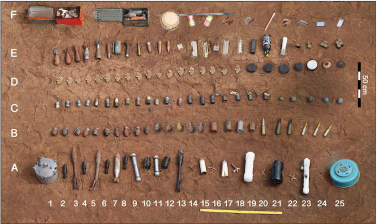
At least 57 nations have live antipersonnel land mines in their territories. In 2024 alone, 1,945 people were killed by mines and 4,325 were injured, 90% of whom were civilians. Nearly half of those were children. Demining operations removed 105,640 mines in the same year.
With new conflicts, the number of mines continues to grow. For farmers, children and others returning to areas after a conflict, a single step can mean permanent injury or death.
I am a Ph.D. student in the Imaging Science Department at Rochester Institute of Technology, working with Emmett Ientilucci. My research focuses on using drone-based, multisensor imagery and artificial intelligence to improve the speed, accuracy and reliability of land mine and unexploded ordnance detection.
Our research aims to do this in three ways: developing techniques for combining data from multiple types of sensors, building benchmark datasets for developing and evaluating detection systems, and improving the reliability of AI detection methods by incorporating estimates of uncertainty.
Multiple sensors from above
Land mine detection still relies heavily on ground-based methods, each with serious limitations. Handheld metal detectors often struggle in mineral-rich soils and have difficulty reliably detecting low-metal or predominantly plastic mines. Ground-penetrating radar can detect nonmetallic objects but performs poorly in wet or uneven terrain, or ground covered by vegetation, and often generates high false-alarm rates. Manual probing and trained detection animals remain effective methods for locating land mines, but the process is slow, resource-intensive and exposes deminers to considerable risk. At the scale of land mine deployment seen in Ukraine and other conflict and post-conflict regions, ground surveys alone cannot keep pace.
Demining operations are increasingly using drone-based aerial imagery to accelerate land mine surveys, particularly for mines laid on the surface of the ground. However, camouflage, vegetation and changing lighting conditions often make these mines nearly invisible in conventional images.
Earlier research my colleagues and I conducted examined whether aerial sensing can realistically replace or support traditional ground-based surveys. We evaluated the viability of substituting an airborne metal-detection system for handheld metal detectors for detecting land mines and unexploded ordnance.
The results showed that drone-mounted magnetic sensing can detect metallic targets with accuracy comparable to ground-based methods in a controlled test site, while reducing human risk and increasing survey speed approximately tenfold. Our heat map, generated by an airborne electromagnetic-induction metal detector over a test site, highlights likely locations of buried land mine and unexploded ordnance targets, illustrating how drone-based sensing can safely and efficiently survey areas where land mines have been deployed.
Aerial detection benefits from complementary sensors. RGB cameras, which detect visible light images in color, capture visual features of land mines. Thermal sensors reveal temperature differences between mines and the ground around them. Multispectral and hyperspectral sensors identify signatures of different materials. Synthetic-aperture radar detects changes in land surfaces. LiDAR maps subtle surface disturbances. And magnetometers detect underground metallic components. Together, these sensors can address the variety of mine types and deployment conditions found in real-world environments.

Despite their potential, multisensor, drone-based land mine detection systems remain underexplored. Progress is limited by the lack of publicly available benchmark datasets with data captured from multiple types of sensors using realistic mine deployments and precise ground truth, meaning the actual positions and depths of the target mines. Without such datasets, researchers cannot accurately compare algorithms, validate test results or develop AI models that work well outside of test environments.
Building mine-detection datasets
To address this challenge, our team along with several other researchers collaborated with the nonprofit Demining Research Community to collect a comprehensive dataset. We used the Demining Research Community’s controlled test field in Oklahoma, which included over 140 inert land mine and unexploded ordnance targets.
We collected a large, georeferenced, multisensor dataset using both ground-based and drone-based platforms at multiple altitudes. We used hyperspectral, multispectral, thermal, RGB, LiDAR, synthetic-aperture radar, ground-penetrating radar, electromagnetic induction metal detectors and magnetometers. This dataset will be released through a journal paper that is currently under review. We have released a portion of this collection – specifically a visible and near-infrared hyperspectral dataset acquired at an altitude of 20 meters – through a conference publication.
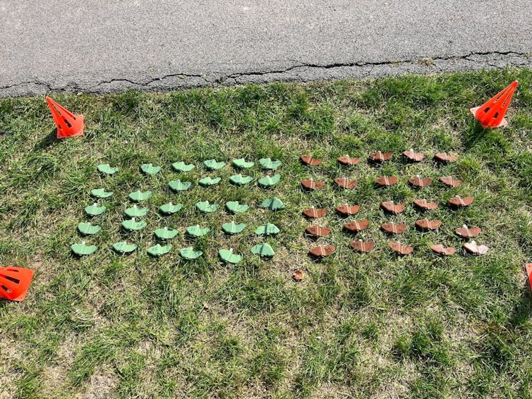
We expanded this effort internationally through a collaboration with the Royal Military Academy of Belgium during a large data-collection campaign. Together, we deployed over 110 replicas of PFM-1 mines across varied terrains and vegetation conditions.
To simulate realistic minefields, we scattered the inert mines to approximate aerial dispersal. We precisely surveyed and geolocated each mine using GPS base stations. We then collected data at multiple altitudes using drones outfitted with hyperspectral, multispectral, thermal, RGB, LiDAR and polarization sensors that reduce glare.
Other research groups, participants and industry partners, including sensor manufacturers, collected additional datasets over the same test field. These datasets are currently being processed and will be released as open-access in the near future.
To our knowledge, these will be the first publicly available datasets of their kind, opening new opportunities not only for land mine detection research but also for the broader AI and remote sensing community. By making these datasets openly available, we aim to accelerate research on multisensor data fusion, improve the reliability of AI-based detection systems, and help bridge the gap between academic research and the needs of industry developers and humanitarian organizations.

Measuring reliability
But even if you carefully calibrate your sensors using our dataset, you still need to recognize the limitations of the technology. In applications like land mine detection, a single mistake can be fatal. A major part of my research focuses on AI reliability and uncertainty estimation. In a recent study, we developed a measure of an AI model’s uncertainty about its predictions.
Rather than forcing models to produce confident predictions at all times, we are developing methods that allow systems to say, “I’m not sure.” Our goal is to provide an uncertainty metric alongside predictions: The noisier or more ambiguous the input, the higher the uncertainty score. This information can help demining operators make safer and more informed decisions, particularly in challenging or uncertain conditions.
With the release of these datasets, we believe new opportunities will emerge for researchers in AI and remote sensing to explore multisensor data fusion. The datasets include a wide variety of targets in terms of size, shape and orientation, with all data fully georeferenced and with precise ground truth. Because each target was observed by multiple sensors at multiple altitudes, researchers will be able to conduct comparative analyses of individual sensors versus combined sensing approaches. This will support the development of more reliable, safer and faster detection algorithms tailored to real-world demining needs.
At its core, this research is not about algorithms or drones, it is about people. It is about farmers reclaiming their land, children walking safely to school, and communities rebuilding without fear. By combining AI, drones and open science, we aim to transform land mine detection from a slow and dangerous practice into a safer, smarter and more scalable process, one that helps turn post-conflict landscapes back into places where life can grow again.


